

Mucanacht [Meacanacht] [Muckanaght]
Good walks are even better shared.
Overview
Overview
Mucanacht, also affectionately known as Meacanacht or Muckanaght, stands proudly at 668 meters, offering both seasoned hikers and those with a more manageable ambition an inviting challenge. The routes are well-trodden, adding a feeling of camaraderie amongst fellow adventurers.
Geology
The mountain's geology is as interesting as its history, with rocks dating back to the Silurian period. The unique schist and slate formations provide a visual feast for geology enthusiasts and add an additional layer of intrigue to the hike.
The Route
The Mucanacht Loop Trail is the preferred route for many, allowing walkers to soak in the picturesque views while keeping the challenges manageable. Expect a mix of grassy knolls and rocky outcrops, with some boggy spots dotted along the way. Keep your boots tied tightly, as these terrains can be slippery.
Summit Features
Reaching the summit is a rewarding experience, complete with a charming stone cairn. It’s a traditional marker that beckons hikers to take a moment to reflect and enjoy the view – and perhaps snap a photo or two!
Views
From the top, the panorama is simply breathtaking. On a sunny day, you’ll be treated to a view that stretches beyond your wildest dreams, with Ben Bulben standing stoically in the distance and the glimmer of Lough Arrow casting a sparkly glow. Bring a picnic and enjoy a leisurely lunch while basking in the beauty around you.
Hazards
Do keep in mind that the Irish weather can turn on a dime. It's essential to prepare for anything from bright sunshine to sudden showers, so don’t forget your waterproof jacket. And watch your step on the more rugged sections of the trail!
Access
The nearest parking is conveniently located at the trailhead in Ballinafad, and local bus services can help you reach there from Sligo Town. It’s a charming little village, perfect for a pre-hike coffee or a post-hike celebration.
Conclusion
Whether you’re in it for the views, the geology, or simply a good hike, Mucanacht offers an enriching experience. Packed with natural beauty and a touch of local folklore, you'll leave with not just memories but perhaps a newfound love for the landscape. Don't forget your camera and a sense of adventure!
Explore routes near Mucanacht [Meacanacht] [Muckanaght]
Public walks starting within 80 km of this hill. Nearby does not mean a route reaches the summit; check its map and access before setting out.
No public routes are currently listed within 80 km of Mucanacht [Meacanacht] [Muckanaght] on Walkmates. This does not mean there are no paths here. Explore the map and check local access information before planning a walk.
Route planning notes
These notes describe possible approaches, not verified navigable routes or permission to cross land. Check current paths, local access rules and conditions before setting out.
Mucanacht Loop Trail
A scenic loop starting from the town of Ballinafad, offering lush landscapes and stunning views while navigating the southern flanks of Mucanacht.
Make a day of it, together
Find someone to share the walk with, or organise a day out along a route you like.
Photo Gallery
View all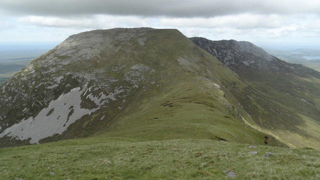 Photo could not load
L7654 : Heading towards Bencullagh from W ridge on Muckanaght
Colin Park
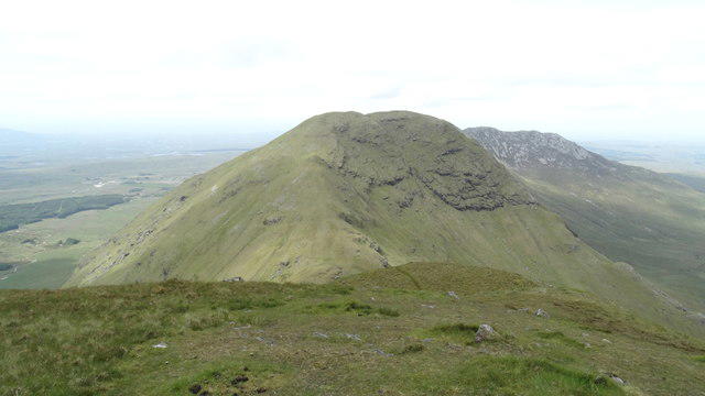 Photo could not load
L7654 : On Benfree with view towards Muckanaght
Colin Park
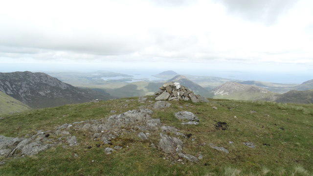 Photo could not load
L7654 : Summit cairn on Muckanaght with view towards Diamond Hill
Colin Park
Hill facts and local notes
Classifications
Elevation
655m
2,149 ft
Prominence
181m
Coordinates
53.5217, -9.8598
L767540
OS Map
37
At the Summit
At the summit, you'll find a modest stone cairn that stands defiantly against the wind, providing a perfect backdrop for a summit selfie.
Terrain & Geology
Mucanacht is primarily composed of Silurian schist and slate, giving it a rugged charm and a geological history that dates back hundreds of millions of years. The schist offers fascinating textures that can be scrutinised by eager geologists and curious hikers alike.
Views & Scenery
On a clear day, one can see the majestic Ben Bulben to the north and the rolling hills of Sligo stretching as far as the eye can see. The stunning Lough Arrow can also be spotted sparkling in the sunlight.
History & Heritage
Name Origin
The name Mucanacht is derived from the Irish 'Meacanacht', meaning 'the dose of pig', perhaps hinting at some ancient connection with local livestock or folklore.
Historical Significance
Mucanacht is a part of the rich cultural tapestry of the area, featuring in local tales and contributing to the stunning landscapes that have inspired poets and artists.
Getting There & Facilities
Check current local access restrictions, parking rules and transport timetables before travelling. These notes do not confirm public access to the summit.
Parking
There is a small car park available at the trailhead in Ballinafad, accessible via the R294.
Public Transport
Local bus services operate from Sligo Town to Ballinafad, but it’s best to check the latest schedules as they can vary.
Nearby Facilities
While the facilities in Ballinafad are limited, a short drive to nearby Sligo offers various cafes and public toilets for hikers' convenience.
Safety Information
Known Hazards
- Uneven terrain and sudden weather changes; it's advisable to keep an eye on the sky – you never know when it might decide to open up and shower you.
General Safety Tips
- Check weather conditions before setting out
- Carry appropriate clothing and equipment
- Let someone know your planned route
- Take a map, compass, and GPS device
- Carry emergency supplies: food, water, first aid kit, torch
Hills
Some common questions about the hills answered
Are there group walks up Mucanacht [Meacanacht] [Muckanaght]?
Many walkers use Walkmates to join or organise walks with others. You can check for group walks around Mucanacht [Meacanacht] [Muckanaght] through the maps
Are there other walkers around Mucanacht [Meacanacht] [Muckanaght]?
Activity varies by location and time, but Walkmates lets you see whether others have shared walks or shown interest in this area. Find other people through the walking friends search walking friends for Mucanacht [Meacanacht] [Muckanaght] search or of course create your own walk for Mucanacht [Meacanacht] [Muckanaght]
Can I organise a walk to Mucanacht [Meacanacht] [Muckanaght]?
Yes. If there aren’t any walks listed already, you can create a walk and make it available for others to join.
If you're signed up to Walkmates, you can create a walk to Mucanacht [Meacanacht] [Muckanaght].
How do I find a walk up this hill?
There are often multiple ways to walk this hill, depending on experience and route preference. Walkmates helps you explore walks and routes that others have shared.
Can I suggest a new route up Mucanacht [Meacanacht] [Muckanaght]?
Yes. You can suggest or create routes to share with others. Walkmates focuses on the social side of walking, so routes are used to help people organise walks and explore areas together, rather than as detailed navigation tools or route libraries.
Other uses really appreciate knowledgeable walkers sharing their routes. Share your favourite route to Mucanacht [Meacanacht] [Muckanaght] here
The is an error or something incorrect about this hill. How do I let you know?
We always strive to keep the information on Walkmates as accurate as possible. If you find an error, please let us know through the contact form and we'll aim to correct it as quickly as possible
Community Discussion
Comments
Location
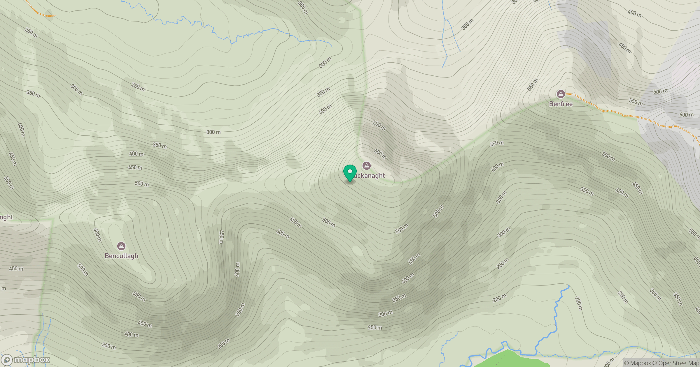
Grid reference: L767540
View on OpenStreetMapOpens a map in a new tab, centred on the hill.
Hills within 30 km
Straight-line distance, not a walking route or confirmation of access.
Mweelrea
814m
Croagh Patrick
764m
Benbrack [Binn Bhreac]
584m
An Chailleach [Bencullagh]
634m
Benbaun
729m
No comments yet. Be the first.